Only one or two hours away, there are very attractive destinations for day hikes from Belgrade. We suggest 15 of them!
Firstly, let's briefly remind ourselves of all the benefits of hiking.
In addition to the purpose of exploring and enjoying the natural beauty, walking or hiking is the oldest type of exercise. Day hikes from Belgrade, are becoming an increasingly popular form of recreation that provides emotional relaxation and, is also great for gaining fitness.

If you live in an urban environment and struggle with stress daily, nature escaping and hiking will be good for you.
Even short hiking tours are having a very positive effect on anxiety and tension. Hiking or simply walking outdoors will help to relieve your anxiety as well as tension on higher levels. There are studies that have proved that 50 minutes of walking outdoor for a day will lower anxiety more when compared to that in the urban areas.
Here are our recommendations for day hikes from Belgrade, that we have put in the order of the shortest distance from Belgrade.
1) Kosmaj
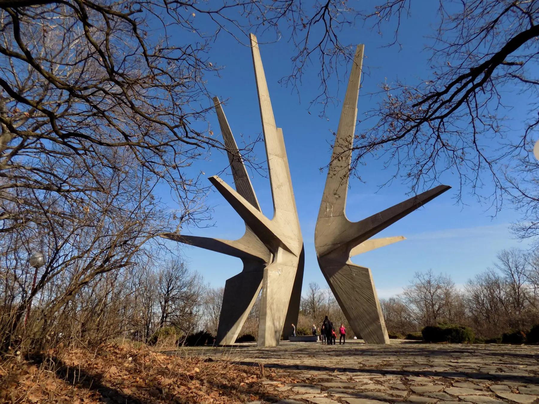
Kosmaj is a beautiful Sumadija mountain with a crescent-shaped ridge 626 m high. Only 60 km from Belgrade is ideal for an escape from the urban environment. It is covered mainly by beech and oak forest with a beautiful walking trail and viewpoints to the surrounding Sumadija mountains. The symbol of Kosmaj is an impressive monument erected by fallen soldiers in World War II.
The hiking tour is circular, not entirely easy due to its ascent and descent.
How to get there and where to go for hiking?
It is best to start from of the Tresije Monastery and go to the Monument to the Fallen Soldiers of the Kosmaj Detachment, then continue further towards the Kosutica lookout point, then to the remains of the medieval Kasteljan monastery and continue towards the Goli vrh lookout point and the Beli kamen memorial from the First World War. After another half hour of walking, you will return to the starting point near the monastery of Tresije.
Information about a hiking trail:
Length: 12 km
Ascent: around 600 m
Duration: 4.5 h
Category: easy
Fans of post-war architecture can admire the attractive, imposing monument from 1971. Monument to the Fallen Soldiers of the Kosmaj Detachment in WWII represents a sculptural-architectural composition consisting of five concrete arms, 30 meters high, symbolizing the libertarian and uprising spark. It is part of a regional cultural tourist route called Balkan Monumental Trail (BMT) It is supposed to revive the art, design, and architecture of World War II monuments, built between the 1950 s and 1990 s across the Western Balkans. This route is a new tourist product for international and visitors from the region looking for a unique cultural experience.
If you are a craft beer lover, after you finish your hiking tour there, we recommend you to visit Kabinet brewery. It the most famous producer of craft beer in Serbia.
If you want to go to Kosmaj in a group, here is ours one-day hiking tour that we are organizing. Also, if you wish we can organize for you private tour on Kosmaj. Please contact us by phone at +38169655777 or by e-mail at info@explore-serbia.rs or through the form below:
2) The National Park Fruska Gora
A long time ago it was a lonesome island in the Pannonian Sea. Now it is a beautiful mountain with mild slopes, centennial forests, famous vineyards, and numerous monasteries. With its highest peak, Crveni Cot at 539 m and an 80 km long ridge, it is the dominant landmass of the entire Pannonian Plain.
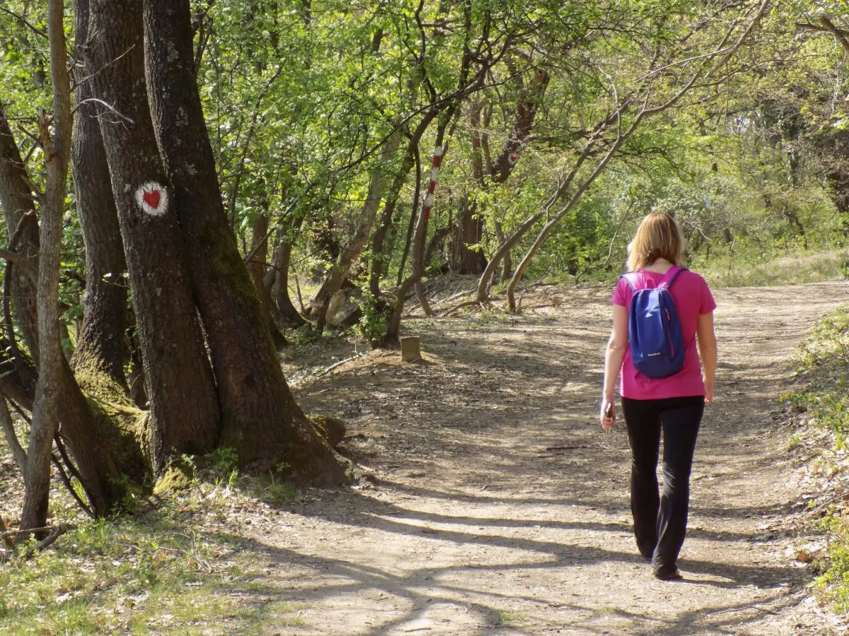
There are numerous opportunities and interesting hiking trails, most of which are marked, from easy to those more demanding tours.
If you want easier hiking tours, we suggest the following trails:
-
Hiking trail from Grgeteg Monastery to Velika Remeta Monastery
Information about a hiking trail:
Length: 7 km (in both directions)
Total ascend/descend: 200 m
Category: easy
Duration: around 3 h with a visit to the monastery
After the hiking tour, you can go to the nearby Perko's Farm where you can enjoy excellent food in a natural ambiance.
-
Circular hiking tour from Iriski Venac – the monastery Staro Hopovo – the monastery Novo Hopovo – Iriski Venac
Information about a hiking trail:
Length: 12 km
Total ascend/descend: 350 m
Category: easy
Duration: around 4.5 h with a visit to the monastery

-
Circular hiking tour Andrevlje – Letenka – Andrevlje
Information about a hiking trail:
Length: 12 km
Total ascend/descend: 350 m
Category: easy
Duration: around 4 h
-
Circular hiking tour Paragovo – Popovica – Popovica Lake – viewpoint to Novi Sad – Eagle’s battlefield – mountain hut Eagle’s nest – Paragovo
Information about a hiking trail:
Length: 9 km
Total ascend/descend: 350 m
Category: easy
Duration: around 3 h
For those who want a little more demanding hiking there are those of medium difficulty:
-
Circular hiking tour Zmajevac – Lazin Vir – Vrdnik – Zmajevac
Information about a hiking trail:
Length: 15 km
Total ascend/descend: 460 m
Category: easy-moderate
Duration: around 5 h
-
Hiking tour from the monastery Beocin – Osovlje – Eagles’ rocks – Chestnut Valley – Red cot – the monastery Beocin
Information about a hiking trail:
Length: 16km
Total ascend/descend: 600 m
Category: moderate
Duration: around 6 h

Fruška Gora is a special area with numerous picnic areas for nature lovers, hikers, and cyclists - you can do all this on your own, but you can also choose from some of our designed programs that we have.
Whatever hiking trail you choose, you can combine all of them by visiting one of the farms, nearby ethno villages, wineries, monasteries or visiting Sremski Karlovci and Novi Sad. With all that Fruska Gora has to offer, it is an ideal destination for one-day hiking tours from Belgrade.
3) Deliblato Sands
Deliblato Sands is the right destination for you if you want easier hiking tours without much ascending.
It is the largest sandy terrain in Europe, once part of a vast prehistoric desert, having originated from the withdrawal of the Pannonian Sea. It has approximately 35,000 ha and sand dunes with a height of 70 to 200 meters. Sand dunes make this area unusually beautiful.

Deliblato Sands is located in southern Banat, situated between the river Danube and the southwestern slopes of the Carpathian Mountains. On its, the north-eastern edge, are located Zagaj Hills. A very attractive area with globular hillocks that are ancient sand dunes partly covered the forest, partly with steppe vegetation, a unique relic of the Pannonian plain landscape.
If you are a fan of landscape photography, you can find real inspiration here.
How to get there and where to go for hiking?
If you would like to go on a hiking tour to the Zagaj Hills, you need to reach the village Grebenac where the circular hiking trail begins.
Information about a hiking trail:
Length: 15 km
Total ascend/descend: 200 m
Category: easy
Duration: 4.5 h
We recommend that you complete the hiking tour of the Zagaj Hills with a visit to Stara Palanka and the fortress RamStara Palanka is a small place with excellent fish restaurants. You can reach Ram fortress by ferry across the Danube from Stara Palanka. If you want to go in a group, we recommend our one-day tour that we organize in May and October, when the spring and autumn colors are in full swing.
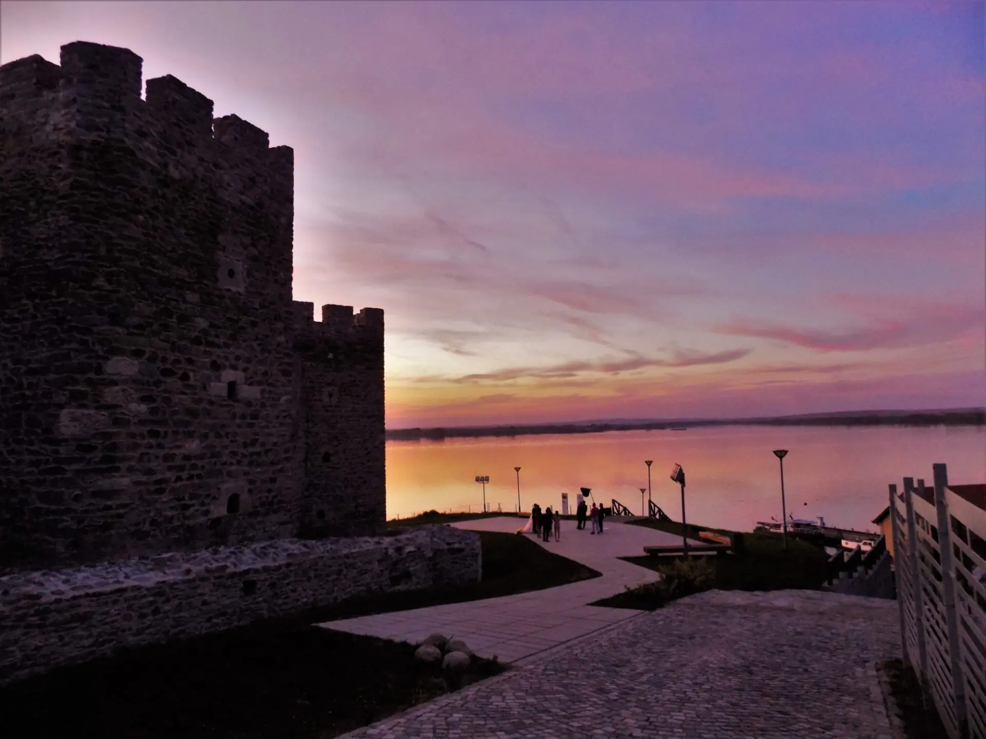
Near the village of Deliblato close to town Kovin, there is the educational and the School-recreation center Cardak where there are also marked hiking trails. Surrounded by forests and meadows, it is an ideal place to stay in nature.
Also, a popular picnic area is the Devojacki bunar near Alibunar, with sports fields, an outdoor swimming pool, walking trails and a unique chalet church in Vojvodina.
4) Rajac (Suvobor)
The right place to escape from the city noise and enjoy the fresh air and untouched mountain landscapes that man has not yet changed by building hotel complexes and apartments.
Rajac is a mountainous landscape and a part of the Suvobor mountain that belongs to the Valjevo mountains. The eponymous peak Rajac is located at 848 m above sea level. This area of exceptional features belongs to the territory of the municipality of Ljig and is one of the most accessible and beautiful for hiking tours from Belgrade, since it offers wonderful views.

Rajac is a real green and tame oasis with many meadows and glades, forests of beech, oak, birch, ash, Quercus cerris tree, and in the highest areas and conifers. There are numerous sources of water, and a large number of herbs grow on the meadows of Rajac. The area got its name from the old travel writers "Heaven on earth."
A walk along the paths of Rajac is actually a walk along the paths of the Battle of Kolubara, for a moment you will travel through time and return to the period of the Second World War when Rajac was the scene of the battle between Serbia and Austria-Hungary.
Uncle Duško's Rajac trails
For those who are a little more active, in good shape, we suggest a circular hiking trail with a total length of 44 km with 14 checkpoints. The transversal is linear, in the shape of an irregular figure eight, the lowest point is in the village of Ba at 350 m above sea level, and the highest at the top of Suvobor is 866 m. IIt takes two days to complete the trail.

However, for a one-day stay on Rajac, we suggest a slightly easier trail from the Mountain Lodge "Čika - Duško Jovanović" to the top of Rajac, the mountain house Dobra voda and the top of Suvobor.
Information about a hiking trail:
Length: 18 km
Total descend/ascend: about 500 m
Category: easy, walking on dirt and forest roads, across meadows
Duration: around 6 hours with breaks
In addition to hiking, Rajac is one of the perfect destinations for paragliding. If you want to realize the old man's dream of flying, delight yourself or a loved one with a paragliding tandem flight on Rajac and enjoy endless views from the air.
If you decide to visit Rajac during the summer, then be sure to do so in the third week of July, when the famous event takes place "Mowing on Rajac".
If you are interested in the cultural heritage of this area, be sure to visit Vavedenje Monastery at the foot of Rajac, where there are sarcophagi with the relics of Đurađ Branković and his wife Jerina, popularly known as "damned Jerina".
5) The gorge of the river Gradac
The Gradac River is the emerald pearl of Western Serbia. It can often be heard that it is the cleanest river in our country, and not only that, it is one of the cleanest in Europe. It springs below the mountain Povlen and is the richest tributary of the Kolubara.
The specificity of this river is that after a few kilometers of flow from the source, it sinks, so it reappears on the surface. The canyon of Gradac, cut by centuries, is 23 km long and is a real paradise for all nature lovers. Particularly interesting are the springs of this river, which flow along its entire course.
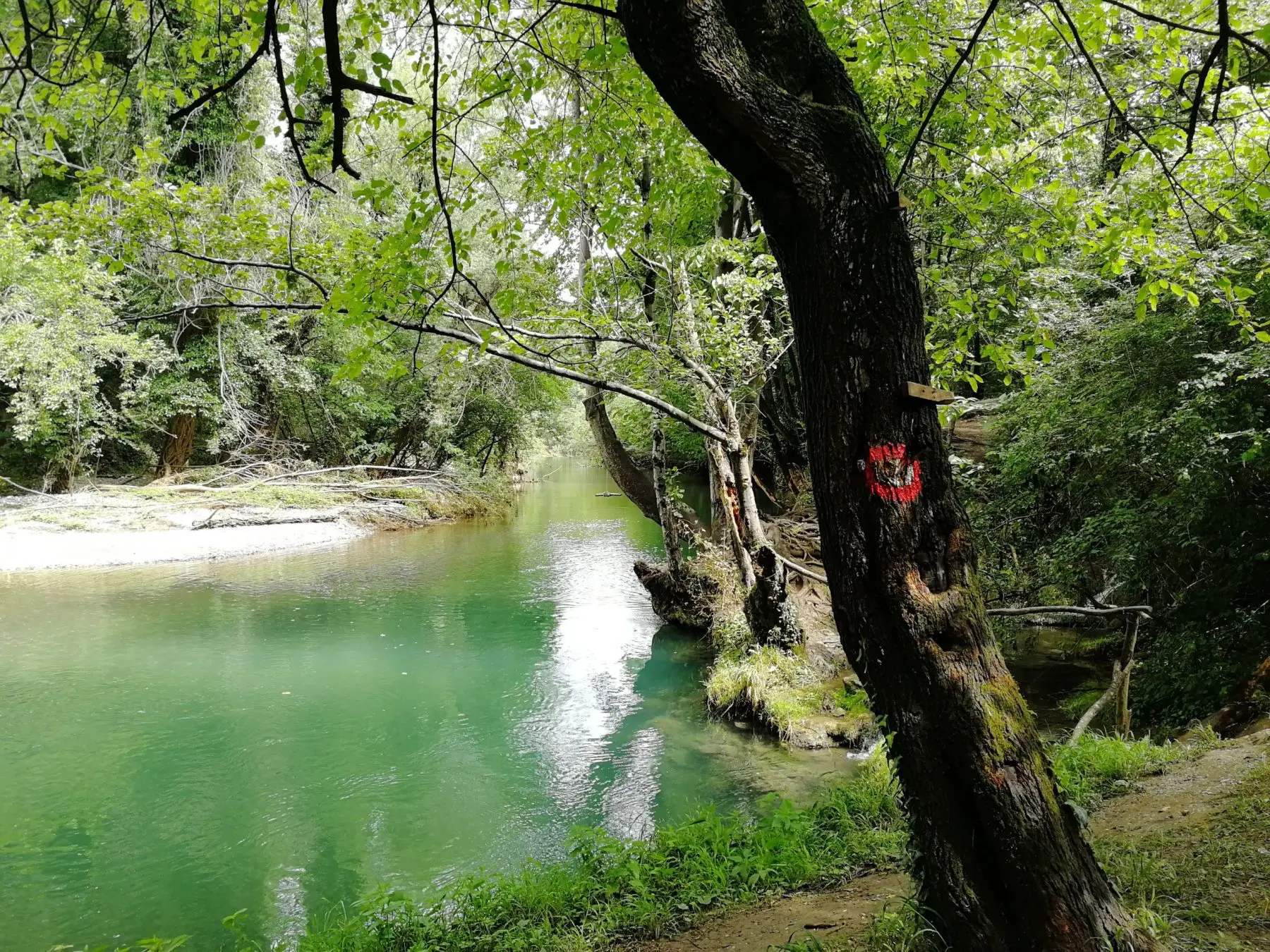
This imposing masterpiece of nature is about 5 km away from Valjevo, and traveling along the Ibar highway about 100 km from Belgrade. The Belgrade-Bar railway passes through the gorge of the Gradac river.
Gradac originates from the confluence of the Bukovska river and Zabava and has a length of 28 km and a total drop of 187 meters to the mouth of the Kolubara.
What makes the Gradac gorge one of the most beautiful in Serbia?
Its greatest value is its preservation from construction and other forms of degradation. There are also sites of great environmental value, lookouts, large forest complexes, and the picturesque flow of Gradac, the peace and quiet that reigns here leave an unforgettable impression on every visitor.
Numerous caves, pits, abysses, springs, sinkholes, side tributaries of Gradac and rich living world in the water and beyond additionally complete the beauty of the landscape. More than 70 caves have been discovered in the river gorge, and there are several mills on the river itself. The most interesting and most visited picnic areas and beaches are Livadica, Ploče, Kriva vrba, Šareno platno.
Hiking tour through the gorge allows you to fully enjoy all its beauty.
There are several ways to hike through the gorge of the river Gradac, as a starting point you can choose the monastery Ćelije or equestrian club Deguric. The trail is easy, it is suitable for beginners in hiking, as well as for children.
Information about a hiking trail:
Length: 12 km + 3 km (ukoliko se ide do izvora reke)
Total descend/ascend: 300 m
Category: easy, walk along the riverbed, forest path, partly across the meadow
Duration: around 5h with breaks
During the summer months, we recommend a walking tour where in the back of the trail (about 5 km) the river is trampled to the knees and crossed from shore to shore. This way you will see the most beautiful part of this fascinating river.
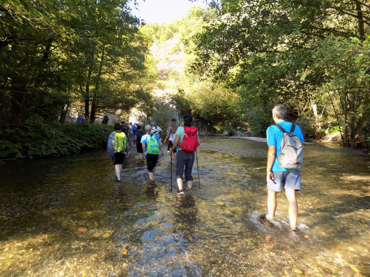
The Ćelije monastery is a complementary whole with the gorge. The Ćelije Monastery, is the endowment of King Dragutin Nemanjić, from the 13th century. Also, this monastery was home to the famous spiritualist, sage, and healer, Avi Justin Popovic, to whom a large number of people still come to visit the relics.
It is no less valuable Lelic Monastery, and you can also visit it during the walk. It is the endowment of the famous clergyman, Bishop Nikolaj Velimirović. It is a beautiful church built in the Moravian style, combining stone, brick, and whitewash, which especially contributes to its charm.
6) Homolje Mountains
In less than 2 hours drive from Belgrade, you can reach Homolje mountains. is a true pearl of Eastern Serbia that represents an ecological oasis with numerous watermills, interesting caves, legends, myths, and customs. It also offers numerous opportunities for challenging hiking tours from Belgrade.
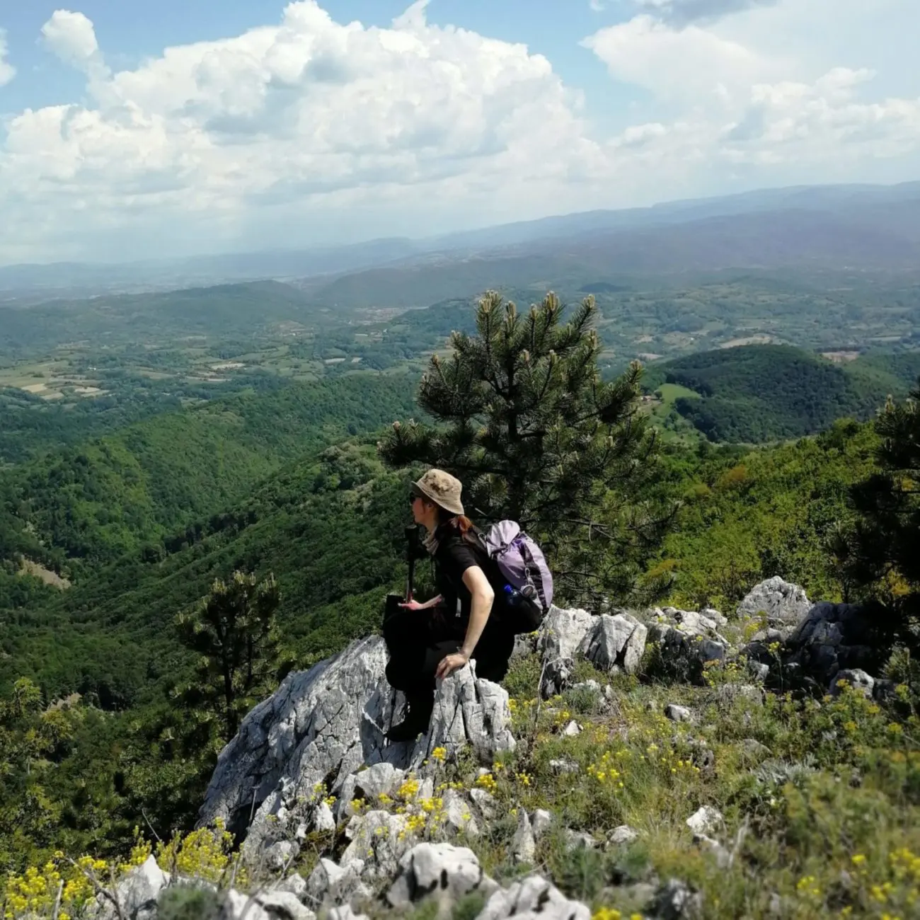
This mountain area is located in north-eastern Serbia where the Mlava River flows. It springs into Žagubica and forms a beautiful Gornjak Gorge.. The gorge is named after the fresh wind of Gornjak, which breaks along the river out the valley surrounded by mountains.
There are numerous hiking trails on Homolje Mountains, ranging from easy to moderate.
-
A very interesting trail starts from the Gornjak monastery.
The monastery lies on the smaller, extended plateau of Mlava in the Gornjak Gorge. it is located next to the rocky cliffs of Jezevac Mount under which the fast and clear Mlava flows. It is the endowment of the Serbian prince Lazar from the fourteenth century.
The hiking trail goes to the peaks Mali (732 m) and Veliki Vukan (825 m). It is a forest path, partly goes through meadows and again through forest paths leading to the ridge and these rocky peaks.
Information about a hiking trail:
Length: 13 km
Ascent: around 650 m
Duration: 6 h
Category: easy-moderate
After this tour, we recommended that you visit the village Bistrica. This village is unique by the number of remaining old watermills on the river Bistrica, more than two centuries old. There are eight watermills on this river and they are all in the function where corn and wheat are being melted as it used to be, 100 and 200 years ago. You can walk there enjoying the forgotten sounds of clapping.
-
Another attractive hiking route is in the eastern part of the Homolje valley where there is an incredibly beautiful plateau of Zdravca.
You can take the trail from the village of Selište, which is reached via the Petrovac - Žagubica road. It passes near the peaks: Kupova Glava (923 m), Coka Njamci (856 m), Coka Korugu (903 m) and Zdravca (897 m). From the very top of Zdravca, there is a phenomenal view.
Information about a hiking trail:
Length: 19 km
Uspon: oko 600 m
Category: moderate
Duration: 7 h – 8 h
-
Interesting attractions that you can visit in the northeast slopes of Homolje, near Kučevo are the Ceremošnja and Ravništarka caves. From one to the other cave it is possible to hike along the mountain peak of Veliki Štubej.
Ceremosnja Cave is rich in cave jewelry, stalactites, stalagmites, cave columns, such as the "On the Eternal Watch" pillar, which is a recognizable sign of Ceremony. The remains of a bear that lived about a hundred thousand years ago were found in this cave.
Ravnistarka Cave has been declared as Nature Monument and is one of the largest caves in Serbia. The length of the tourist trail through the cave is 560 meters. Ponorac stream flows through Ravništarka. It is also very rich in cave jewelry and has only one cave hall - '' Black Castle ''.The caves characteristics is its main channel, which looks like a giant tunnel, richly decorated with a variety of cave jewelry.
Information about a hiking trail:
Length: 14 km
Duration: 4 h
Category: easy
Ascent: around 650 m
The trail is rich in beautiful views of the flat Pomoravlje, corrugated Sumadija and the steep slopes of the Southern Carpathians in neighboring Romania.
7) Ovcar-Kablar Gorge
In the central part of Serbia, where the Western Morava River has cut the rocks of Ovcar and Kablar with its flow, it is located one of the Serbian most beautiful gorges. The Ovcar-Kablar Gorge is a protected natural area with about 150 species of birds, 30 species of fish and more than 600 plant species. It is distinguished by the steep, high limestone sides with several caves. The gorge is carved between the 985 meters high mountain of Ovcar on the south and 889 meters high Kablar on the north, thus gaining its name.
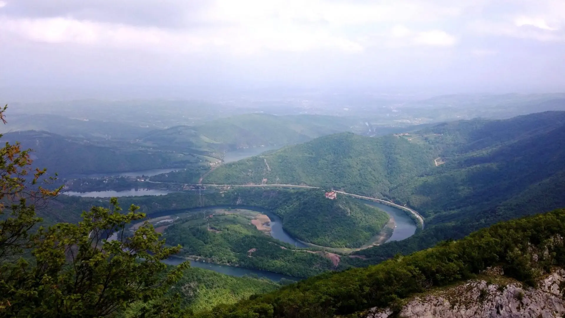
With the construction of a new highway, it can be reached in less than 2 hours from Belgrade.
The Ovcar-Kablar Gorge provides numerous hiking opportunities. The trails are well marked with a red circle and a white dot inside it.
In the table below you can see the names, trails numbers and other details, and you can find an overview of the route maps here.
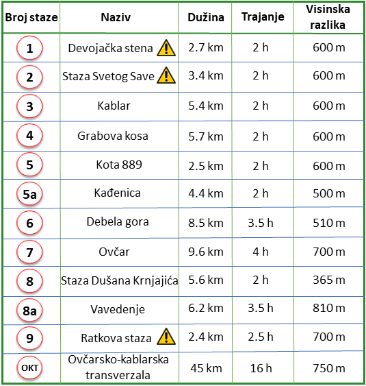
You can also download an application the Tourist Organization of Čačak from Play Store, where you can see all the hiking trails on your mobile phone.
The trails are of different difficulty and length, but all enjoy the views of the gorge. From the viewpoint from the top of Kablar and Ovcar there is a phenomenal view of the meanders of the Western Morava River.
If you like other activities except hiking, you can go on via ferrrata Kablar or enjoy a kayak tour there.
The Ovcar-Kablar Gorge is also known by many monasteries, churches, and chapels widely known as “A Small Serbian Holly Hill".
8) Divčibare (Maljen)
Another attractive hiking destination is Divcibare. It is a plateau on Maljen mountain that is 110 km away from Belgrade. Divcibare is at an altitude of about 1000 m with a pleasant and mild climate and several nature reserves.
Flowering meadows adorned with white daffodils, rich flora and fauna, plenty of springs and conifer forests, especially pine trees - make Divcibare attractive both in winter and summer.
Accommodation in Divcibare is very diverse and you can find it in many villages in this area.

The hiking trails are marked very well and we recommend a circular trail of about 15 km. It leads to the highest peak of Maljen, Kraljev sto at 1104 m.
From the center, the trail leads to the Crni vrh (1098 m), the peak of Velika Pleca (1050 m), then to the peak Kraljev sto, then to the peaks Stražara (1050 m) and Golubac (1056 m) and again to the center.
Information about a hiking trail:
Length: 18 km
Ascent: around 800 m
Category: moderate
Duration: 6 h
You will enjoy the views of the surrounding Valjevo Mountains, Rajac and Ravna Gora. Numerous viewpoints offer a magnificent view of the Sumadija mountains as far as Kopaonik, Sokolske mountains, Zlatibor, Tara, Golija, and Durmitor.
Nature reserves on Divcibare are the old forest at Velika Pleca, the Devil's Source on the Black Kamenica River and the Black River Canyon. Particularly interesting is the 20 meters high the Skakalo Waterfall on the Monasterica River.
You can complete the hiking tour in Divcibare by visiting a nearby town Valjevo.
9) Tometino polje (Maljen)
The landscape of unreal beauty at the foot of Maljen, covered with yellow grass during the fall, resembles a prairie and completely differs from the neighboring, wooded Divčibare. Tometino polje is the name of the same name for the plateau and the settlement, and it is located in the municipality of Požega in the Zlatibor district.

It is about 125 km away from Belgrade, a 2.5 hour drive along the road that leads through Lajkovac, Mionica and Divčibare. This fairytale landscape at an altitude of 750 m is a real natural oasis with beautiful views of the surrounding grassy slopes, the meander of the river Kamenica. The river Kamenica originates in Tometino polje, on the southern slopes of Divčibare from Bela and Crna Kamenica and flows into the West Morava upstream from Čačak.
Below Tometino polje is the confluence of Kozlica and Kamenica. The Maljen tameness is replaced here by the rocky cliffs around the Vlašić hill (716 m) below which Kozlica, and then Kamenica, form unexpectedly wide meanders like a knife cut into a mountain. This area is often called "Eagle's Nest" among mountaineers.
At the end of the asphalt road that leads to Tometino polje, the adventure begins:
The first "station" is the top of Golo brdo (710 m), with a view of Divčibare and Subjel. It takes about half an hour to walk from the beginning of the trail to this peak.
Throughout the trip, there are attractive landscapes, with beautiful views, and the most impressive is the lookout point Klik. From here, the meanders of the Kamenica River and the Eagle's Nest can be seen in the palm of your hand. Opposite Klik is Vlašić, the highest peak of this area. The terrain is clear and it is not difficult to reach Vlašić, it only takes an hour to walk from the Klik lookout.
Information about a hiking trail:
Length: 12 km
Total descend/ascend: 400 m
Category: easy, walking on grassy areas
Duration: around 5h with breaks
The beauty of Tometino polje offers something for everyone: a river, a mountain, a valley, trapped meanders, forests, meadows and pastures. Unity with nature fills the soul and restores the feeling of freedom.
The place is ideal for active holidays and daily hiking tours from Belgrade. In addition to the migratory routes of birds, there are about 52 km of hiking trails and 30 km of those intended for cyclists. The trails are suitable not only for mountaineers, but also for other nature lovers.
10) Povlen – the highest among the Valjevo mountains
Povlen stands out with its height, beauty and untouched nature in the Valjevo mountains. It consists of several peaks where the highest is Mali Povlen with 1347 m, then Srednji Povlen 1301 m and Veliki Povlen 1271 m. The Pannonian Sea, which existed in the area of today's Vojvodina, also flooded the slopes of Povlen. Dense forests and deep river canyons are the main features of this mountain located about 30 km southwest of Valjevo.

The rivers Trešnjica, Sušica, Gradac, Rogačica, Skrapež spring on Povlen. Its northern edge is crossed by the river Jablanica, and the Drina along the edge of the southernmost hills. The Trešnjica canyon is a natural asset of exceptional importance, placed under protection in order to preserve the population of the griffon vulture - the emperor of heights and the purifier of nature. In the canyon of Trešnjica, every spring, a natural spawning of young fish takes place, which is called "Drina's beauty" or "Queen of Drina", and belongs to the trout family.
The mountain has many hiking trails, each a story in itself and allows you to move through untouched landscapes, and the landscapes are most beautiful in autumn when the golden-yellow hues merge with the blue sky above Povlen.
From where to go hiking and ascend to three peaks of Povlen?
- The hiking trail starts near the mountain lodge in Povlen. The beginning of the trail goes through the forest and is relatively steep, leading to the top of Veliki Povlen at 1271 m. Then it continues along the ridge to Srednji Povlen at 1301 m.
You will be overwhelmed by the feeling of satisfaction and pride after climbing all three peaks, with a view that takes your breath away.
- This is followed by descent and ascent to the highest peak of Povlen, Mali Povlen at 1347 m. The climb is steep but short. The return to the starting point of the hiking trail goes at the foot of the peaks and ends at the mountain lodge.
Information about a hiking trail:
Length: 10 km
Total descend/ascend: 650 m
Category: srednje–easy
Duration: around 5h with breaks
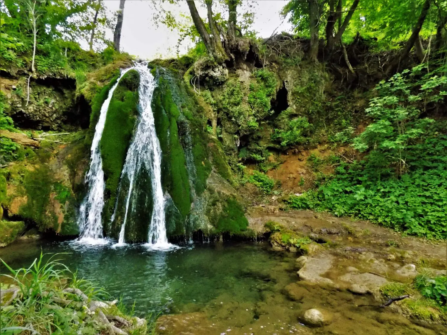
A visitof the Taor springs at the foot of Povlen in the village of Donji Taor will complete your impression of this Valjevo mountain. A spring erupts from the cave opening, and the water flows over the accumulated carbonate deposits and waterfalls are formed.
In this adventure of climbing the peaks of Povlen, you should not bypass Valjevo, a city of rich cultural and historical heritage, with the ambient whole of Tešnjar and restaurants that exude tradition.
11) Borački krš
This destination will pleasantly surprise you. Boracki Krs is a unique geological phenomenon, that has been declared a natural monument. It is located in Sumadija village Borac in the area of the municipality Knic. It encompasses part of the Rudnik-Kotlenica area between Rudnik, Kotlenic and Gledic mountains.
It represents a rare form of relief an elevation that is part of an extinct volcano of about 20 million years old. It is made of rocks of great strength and stability.

It takes about 2 hours drive from Belgrade to reach this attractive destination.
From its peak, at 515 m there is a fantastic view of Sumadija, Gruza Lake and the village of Borac.
To the peak takes a hiking trail that is not demanding. It is an easy hike for all ages, about 4 km long with ascending around 300 m. The trail starts near the church of the Holy Archangels in the village Borac.
At the very top, there is a trail for the braver ones called Pera's Trail. It leads to one part of the ridge, which involves climbing the rocks. The trail is short but attractive.
During the Middle Ages, Borac Krs was an important fortification and on it, there was the city of Borac, strategically placed in the best place in this part of Sumadija, from whose towers the entire valley of Gruza was visible. The Church of the Holy Archangels in Borac, together with The Medieval Town of Borac and The Old Cemetery represents an immovable cultural property as a cultural monument of great importance. It was erected in 1359 during the famous Nemanjic dynasty. Numerous legends and folk tales are tied to her past. According to one legend, Prince Lazar and Princess Milica came to the church before The Battle of Kosovo.
Before or after the hike at Boracki Krs, you can visit Arandjelovac, Topola, and Oplenac, where is the royal complex of dynasty Karadjordjevic.
12) Cer
Visit the historical area where the glorious history of Serbia was created!
Cer Mountain is located in northwestern Serbia, about 100 km southwest of Belgrade and 35 km from Sabac. The highest peak is at 687 m, and from the slopes of the mountain there is a view of the Macva plain to the Sava and Drina and the slightly undulating Pocerina. The mountain is named after numerous trees of the Quercus cerris tree, it is quite wooded, uninhabited. Cer is rich in deciduous trees and low vegetation, as well as blueberries, wild strawberries, mushrooms and medicinal herbs.
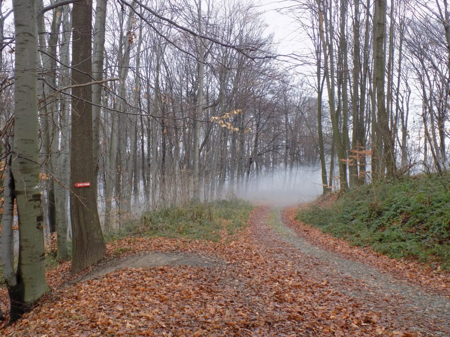
It is an ideal destination for anyone who needs an escape from the everyday city ruts. Its pleasant climate, relaxing landscapes, good and meaningful views are good for refreshing the spirit. They say that movement is a cure, and since Mount Cer is ideal for walking, it is no wonder that they recommend it to heal our souls.
The ascent to Cer is not required, except for recreational hiking, this mountain is also suitable for cycling. This mountain has a rich flora that gives extra atmosphere during the walk.
To start hiking, it is best to reach the mountain lodge "Lipove vode", from where you can take the circular hiking trail, which leads to the monastery Radovašnica, through Kosana town, Krstovi, Šančina. In the end, you can visit the remains of the Roman fortress Trojan's city, as well as the church Church of St. John of Shanghai, memorial church to the fallen Serbian heroes in the Battle of Cer.
Information about a hiking trail:
Length: 15 km
Total descend/ascend: 500 m
Category: easy
Duration: around 5h with breaks
The natural beauties of Cer are complemented by anthropogenic values and the glorious history of this area.
- On Cer, it is inevitable to visit the Memorial Complex to the Heroes of Cer on Tekeriš.
- From this mountain comes the legend of the emperor Trojan and his five daughters, Kosana, Koviljka, Vida and Soka, after whom the cities were named Soko-grad, Koviljača, Vida's town and Kosana's town (on Cer). The name of the fifth daughter was Draga.
- The remains of the military fortress Trojan's city from the 3rd century BC, testify to the rule of the mighty Roman Empire.
- The archeological site of Konjuša dates back to the early Byzantine period, 5th and 6th centuries.
- According to the legend from this area, Miloš Obilić comes from the village of Miloševo, when the people believe that he built the Čokešina monastery.
- There are two other important monasteries on Cer: Radovašnica and Petkovica.
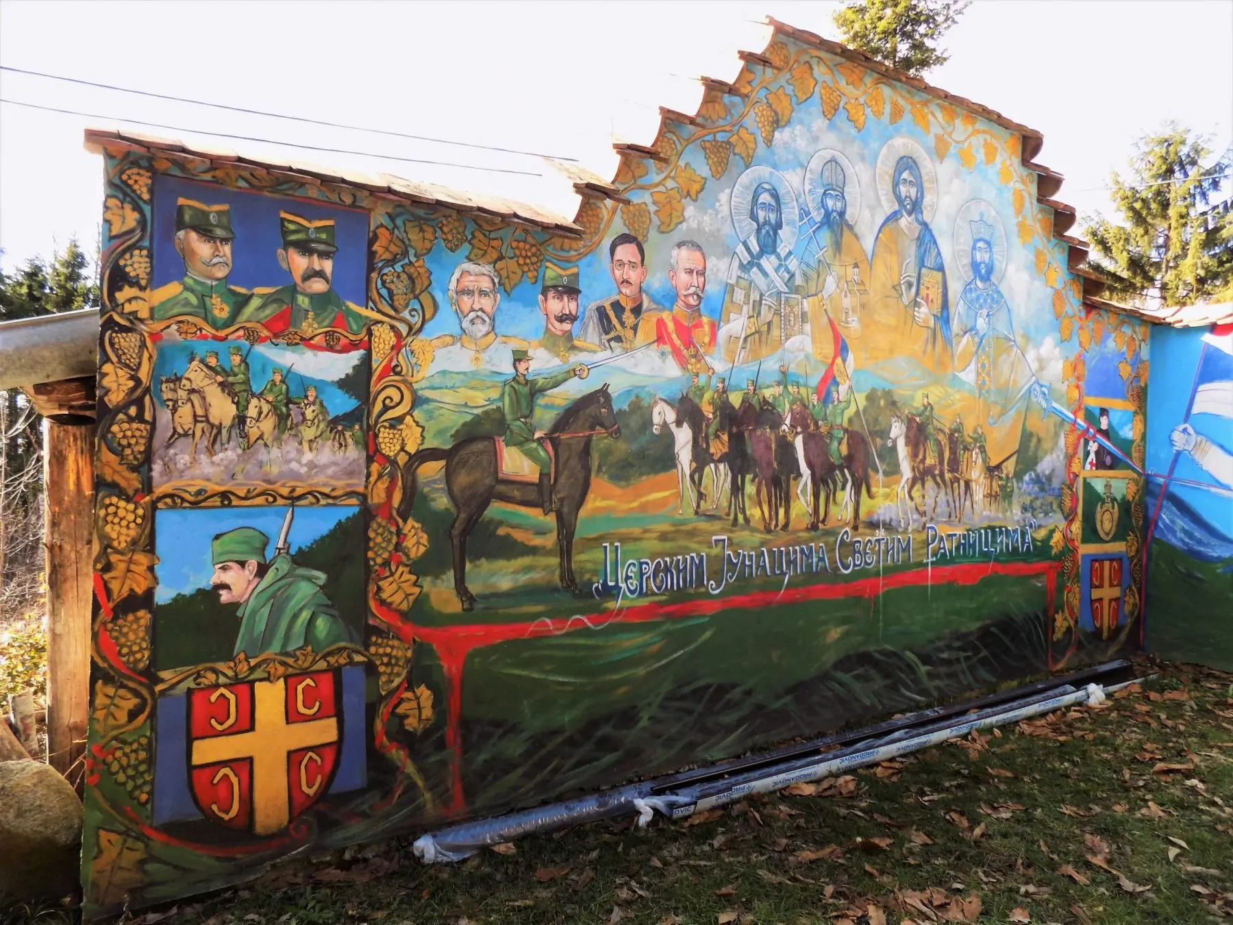
Cer is best known for the famous battle in the First World War, in August 1914. After the victory, Šabac was liberated, with which the Austro-Hungarian army definitely left Serbia. Cer Mountain is a real tourist trump card of northwestern Serbia and can surprise you in many ways.
13) Djerdap National Park
The Djerdap National Park lies in eastern Serbia, on the border with Romania. The magnificent gorge is known as the Iron Gates. The Djerdap gorge is the largest river breakwater in Europe, originated where the mighty Danube broke through the Carpathian Mountains 90 kilometers long.
It consists of 4 gorges: Golubacka, Gospodjin Vir - whose tourist center is Lepenski Vir, Kazan – where the river is the deepest with 90 m) and Sipska, and 3 valleys: Ljupkovska, Donjomilanovacka, and Orsavska. Here in Djerdap, Danube is the deepest 90 m, narrowest 140 m, but also the widest, almost 7 km near Golubac.
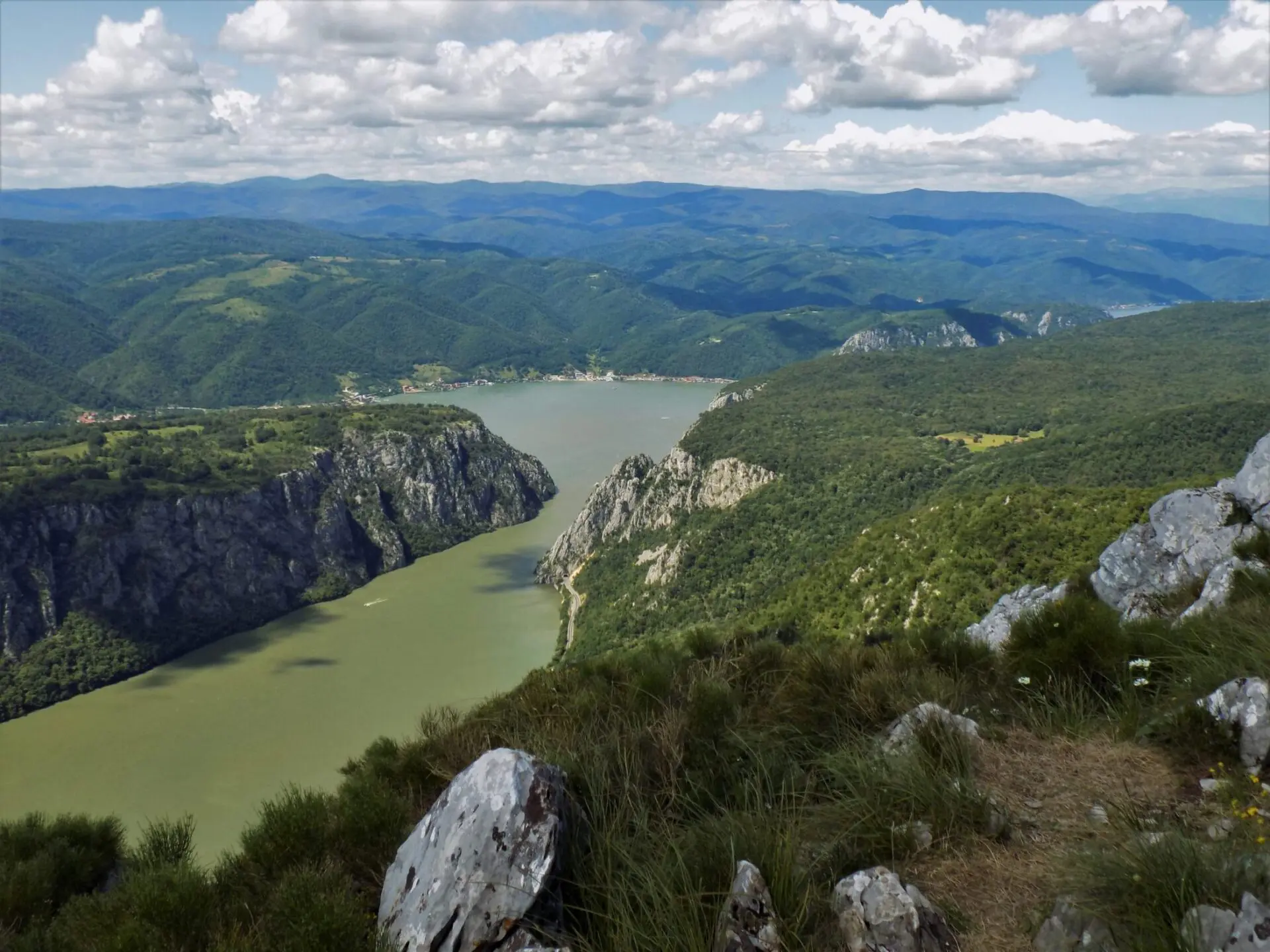
Djerdap National Park is the largest in Serbia. It is a true paradise for adventurers, nature lovers, fishermen, and hunters. This protected area includes as many as ten nature reserves, ten continents of the diverse heritage of nature, history, and beauty, which are carried by large rivers.
When you go for a hike in Djerdap, be prepared for phenomenal views of the spectacular gorge and the mighty Danube. hiking tours from Belgrade to Djerdap can be completed with visits to important cultural and historical monuments, such as the Golubac Fortress and an archaeological site Lepenski Vir.
There are many hiking trails in the Djerdap National Park. Depending on the starting point you choose, you will need a 2 h to 3 h drive from Belgrade.
Hiking trails are marked but we highly recommend you to go with a guide. You can also contact the office of the national park Djerdap where you can also find descriptions of some hiking trails.
National Park Djerdap is also part of E4 European long-distance walking path..
The easy hiking trail that we recommend is to the viewpoint Kovilovo.
After a 2 h and 20 min drive from Belgrade, before Donji Milanovac, you should turn towards the road that leads to Majdanpek. It passes by Captain Misha Hillock (Kapetan Mišin breg).
The trail, in part, goes down an asphalt road from Captain Misha Hillock, then continues through the picturesque landscape. You reach Kovilovo, a vast meadow from which you have a wonderful view of the valley of Donji Milanovac, Lepenski Vir, the sunken Poreč Island, Donji Milanovac, Golubiinje and the Romanian side of Djerdap. Kovilovo is at 358 m, another name is Golo brdo.
Information about a hiking trail:
Length: 4 km
Duration: 2 h
Category: easy
Ascent: around 200 m
Moderate demanding hiking trails that we recommend in Djerdap are:
-
Viewpoint Sokolovac, Canyon of the Boljetin River
Hiking tour is medium category lasting about 6 h.
The hiking trail goes from the confluence of the river Pesaca in Danube, passing a Coka Njalta ridge to the viewpoint Sokolovac at 683 mThen start descending to the attractive Boljetin River canyon. The trail is 18 km long with about 800 m of ascent.
The trail is very attractive, with a fantastic view of the gorge Gospodjin Vir, the peak Somrda and the Romanian nature park Portile de fier on the other side of the Danube.
Information about a hiking trail:
Length: 18 km
Duration: 6 h
Category: moderate
Ascent: around 800 m
-
Hiking on the mountain Miroc to the peaks/nature reserves Mali and Veliki Strbac rezervata prirode Mali i Veliki Štrbac
It takes about 3 hours drive from Belgrade to reach Miroc. You take the highway towards Pozarevac and exit towards Veliko Gradiste. You pass Golubac, then Donji Milanovac and Golubinje. After passing through Tunnel No. 4, on the right side of the road, there is a fountain with parking where the hiking trail to Miroc starts.
The Miroc mountain includes several peaks. Mountain peak Strbac, as the highest peak of Miroc at 767 m that rises above the narrowest part of the Danube in Europe. It is one of the richest mountains in Serbia by a number of caves, coves, and hollows, as well as other speleological formations.
The trail leads through a forest path, and at the peak of Mali Strbac at 626 m is rocky. It starts from a place called Pecka bara at an altitude of 89 m where begins a forest path to Ploce, a limestone plateau under Veliki Strbac.
At Ploce plateau there are three viewpoints at an altitude of 355 m. From there is a unique view of the Danube and parts of the most beautiful Gorge Kazan. They are at a distance of about 3.5 km from the starting point.
 Djerdap, the viewpoint Ploce
The hike then continues to the peaks of Mali and Veliki Strbac.
The trail abounds in beautiful views towards the Danube and the Romanian side of Djerdap. It is possible to see the sculpture of the last Dacian king - Decebalus Rex, carved into the rock, then the monastery of Mrakonija.
Information about a hiking trail:
Length: 16km
Duration: 6 h
Category: moderate
Ascent: around 800 m
14) The Nera Gorge-Beușnița National Park (Romania)
In neighboring Romania, near the border with Serbia, is located The Nera Gorge-Beușnița National Park (Cheile Nerei-Beusnita). It is one of the most beautiful places in Romania and a perfect destination if you are looking for a relaxing walk in unspoiled nature. Outside other popular destinations, biodiversity is preserved in the national park. It is the longest gorge in Romania, characterized by its unique blue lakes and waterfalls.
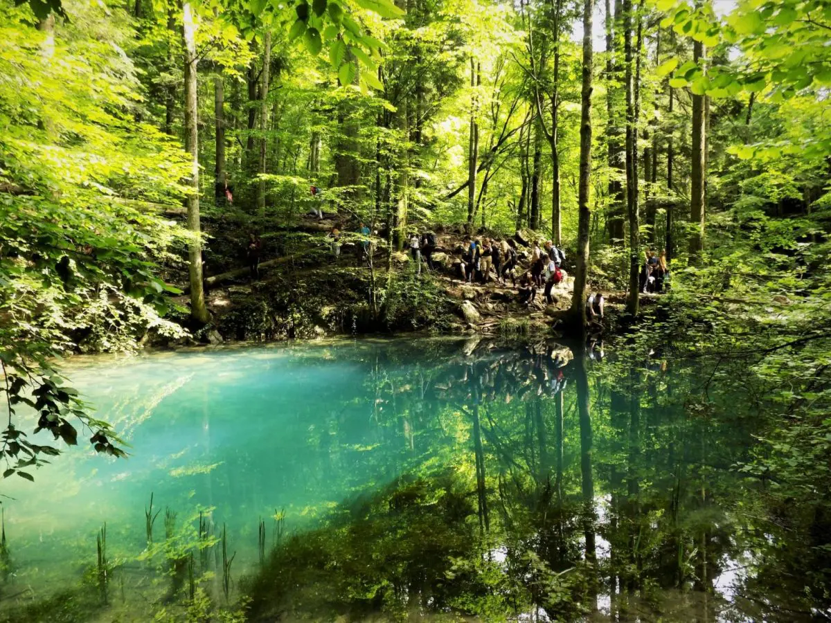
It is located in the southern part of the Anina Mountains, just 2.5 h from Belgrade, some 30 km away from the Kaluđerovo border crossing.
If you want to visit this area of unreal beauty on your own, the starting point from where you go for a hike is the ramp in front of the entrance to the national park. The hiking tour is not demanding, as there are no major climbs on the trail. It is about 16 km long.
At the hiking tour, you will see a luminous landscape with cliffs, valleys, caves, waterfalls and rare lakes. The most famous natural attractions are The Bey's Eye, Beusnita Waterfalls, La Vaioaga Waterfalls, and Devil's Lake.
La Vaioaga Waterfall (Cascada La Văioaga) is the first on the trail that you can admire in the national park. It is easily accessible, located about 3 km from the entrance to the national park.
The Bey's Eye (Ochiul Beiului) is the most popular attraction throughout the year. It is only 3 m deep and receives water from the karst spring. Turquoise blue color never changes and the lake never freezes. It is named after a local legend about a tragic love story. Legend says that the son of a Turkish bey fell in love with a beautiful Romanian shepherdess. Because they couldn't be together, the young bey shed a river of tears and wept his eyes from sorrow. From the tears came the lake in the color of his blue eyes, and from the eyes of the young shepherdess the river Beušnica.
Another legend says that during Sânziană during the summer celebration in Romania, the villas gather around the lake where they dance and bathe. They also put spells on people with their charm.
The lake is just a 30-minute walk from Podu Bei.
Beusnica Waterfalls (Cascada Beușnita) - are located less than half an hour from The Bay's Eye. They represent a series of small waterfalls leading to the most impressive, 5 m high, covered with moss and lichens.

Devil's Lake - is of turquoise color, 12 m deep, formed after the collapse of the vault of the cave. It was named after a legend, that is, a devil who drowned in the dark waters of a cave.
If you want to go on this tour with an organized group, in this case, the trail is about 20 km long. The final part of the trail then leads to the village of Sasca Romana, passing through rocky tunnels by the river Nera. Just before the village, it crosses a wooden suspension bridge.
Information about a hiking trail:
Length: 21 km
Ascend/descend: 150 m
Duration: around 7 h
Category: easy
15) Rtanj
Last but not least is Rtanj mountain. A mystical mountain with a unique huge three-sided pyramid of unique, almost the right shape, is one of the favorite hiking destinations.

It takes about 2.5 hours drive from Belgrade to reach Rtanj. It is located about 200 km southeast of Belgrade near the place Boljevac.
No matter the time of the year or the weather, Rtanj always attracts a large number of hikers. It belongs to the Carpathian-Balkan mountains. At its peak, Šiljak at 1565 m you can climb from the southern and northern sides of the mountain. Both trails are very well marked.
The ascent up the north side is more demanding as the higher altitude difference is overcome, but the trail is more beautiful and interesting. All the way to the peak, the trail goes through the beautiful coniferous forest. From the peak, there is a phenomenal view of the surrounding mountains. If visibility is good, in the north you can see Avala near Belgrade and in the south Stara Planina and Shar Mountains.
-
The starting point from where the ascent to the north side begins is quarry Mirovo.
Information about a hiking trail:
Length: 15 km
Ascent: oko 1200 m
Descend: 970 m
Duration: around
Category: Moderate to challenging
-
The ascent to the south side is less demanding. The starting point from where the ascent to the south side to the peak begins is village Rtanj. From the peak Šiljak return back to the starting point is along the same path.
Information about a hiking trail:
Length: 14.5 km
Ascend/descend: 970 m
Duration: around 7 h
Category: moderate
Due to the length of the hike and if you are going for a one-day hiking tour in Rtanj, you need to leave Belgrade as earlier as you can.
The unique experience of climbing to the peak Šiljak is Rtanj night ascend where hikers wait for sunrise. The scene is truly magnificent. If you want you can go on an overnight climb with an organized group. Such a tour we usually organize in the late spring and early summer months.

After descending from the peak, you can go for sightseeing and relaxation in Sokobanja or at the source of the river Grza.
What else makes Rtanj the unique mountain of Serbia?
The meaning of the name of the mountain itself, which is believed to have originated from the old civilization of Artania, which inhabited the area of Rtanj, instilled in the people the belief that Rtanj is a healing mountain.
The special healing powers of Rtanj herbs help to heal wounds and cuts faster and to recover vital energy. The most famous of them is Rtanj tea (Satureja montana). The symbol of the mountain is also an endemic species, Rtanj mint, which grows only there.
In 2018, Rtanj was declared a Special Nature Reserve by the state due to its endemic and relict flora and fauna as well as the specific form and composition of the relief.
At the foot of Rtanj is a park-forest, unique in Europe, with about 150 species of trees and shrubs. Mixed forests of fir and beech are predominant in Rtanj, and their particularly interesting inhabitants are large blue butterflies, short-legged lizards, fairy cavalry, and many species of birds. In the pastures and meadows, there is often hawthorn bush, wild rose, steppe almond ...
Amazing stories circulate about Rtanj – it is the mountain of salvation, the mountain of aliens, the generator of energy, a place visited by strange beings.
In 2012, when it was announced that there would be an apocalypse and the end of the world, Rtanj became known beyond the borders of Serbia. A number of foreign media then reported that Mount Rtanj would be one of the few in the world to be bypassed by the apocalypse. In December 2012, a large number of foreign nationals sought rescue from the apocalypse in the village of Rtanj and the surrounding villages. The apocalypse was still absent that year, but Rtanj became known worldwide as the mystical "Serbian pyramid".
Previously, Rtanj was visited mainly by mountaineers, herb collectors and hunting enthusiasts. After 2012, Rtanj becomes interesting to a much wider guest structure. It is frequented by holiday lovers of domestic crafts, even those who believe in conspiracy theories and expect to see aliens and flying saucers on Rtanj.
At the "Vrelo" energy site, which is believed to have the beneficial effects of natural magnesium, increasing number of tourists coming to relax and "recharge" the body. In addition to many beliefs in the mystical powers of Rtanj, science acknowledges that there is an anomaly of the geomagnetic field on Rtanj that cannot be explained.
We hope that we have helped you to choose and plan your hiking tours from Belgrade. If you are interested in other hiking destinations in Serbia, search and choose one of our carefully designed tours.
So, hike as much as possible because it is the simplest and most effective way to maintain and improve your health!
On the map below you can find all these destinations for day hikes from Belgrade.



Comments